 |
| Moscow Mountain, winter 2011 |
We don't have a cottage here, or any real estate at all. But it is where I spent seven years during my youth and it is probably our most frequent vacation destination.
There is plenty of natural beauty in Idaho, especially the central and northern sections, but there are no national parks, save for a sliver of Yellowstone on the state's southeastern border. There are plenty of national forests, but the state also boasts huge acreage of privately-owned and privately-leased timberland, rangeland and mines. It is a beautiful state, full of natural resources, but most people do not consider it spectacular.
Few tourists pass through Moscow, Idaho.
It isn't on a direct route to anywhere. Most travelers pass through Idaho from east to west, on one of the Interstate Highways, I-84 or I-90, or on U.S. Highway 2 through the narrow tip of the state's "panhandle," or on the more recent punch-thorough the spine of the Rocky Mountains, U.S. Highway 12 through Lewiston.
 |
| With sister & brother at Lolo Pass, new U.S. Hwy 12, 1964 |
There is another Interstate Highway in Idaho, I-15, that runs north-south, criss-crossing the continental divide several times between Montana's state capitol of Helena, through the mining mecca of Butte, and into Idaho Falls, then south through Pocatello toward Salt Lake City. But that route only serves part of southeastern Idaho, west of Yellowstone and Grand Tetons national parks in western Wyoming. Another U.S. Highway, 93, descends south from Missoula, Montana, through another portion of southern Idaho, from Salmon to Twin Falls and then to the Utah border.
 |
| Remote portion of the Salmon Mountains, central Idaho |
There is only one north-south truck route that traverses the entire 400-mile length of this roughly boot-shaped state, from Canada to the Utah border, U.S. Highway 95. It is one of the most unpredictable stretches of U.S. Highway in the nation, climbing over passes, switchbacking into canyons and up again, and winding through Indian reservations, ranch country and timber installations. Much of the route is notorious for treacherous patches of "black ice," curves, washouts and blind intersections. So unless you are a rancher or a trucker in the timber industry, there is little occasion to drive through Moscow, situated where Highway 95 intersects State Highway 8, roughly 150 miles south of the Canadian border. After serving a handful of hardscrabble timber towns in the Palouse Range, the state highway narrows, then terminates at Elk River, lacking the will to climb the impenetrable Bitterroots that form the state's eastern border.
 |
| Administration Bldg., University of Idaho, Moscow |
At one time a seventh-day sabbath minister who resided in Moscow attracted a large national following, and envelopes of cash, by selling mail-order enlightenment, but that was a passing religious fad that had faded by the mid-1960s when I enrolled in at the University.
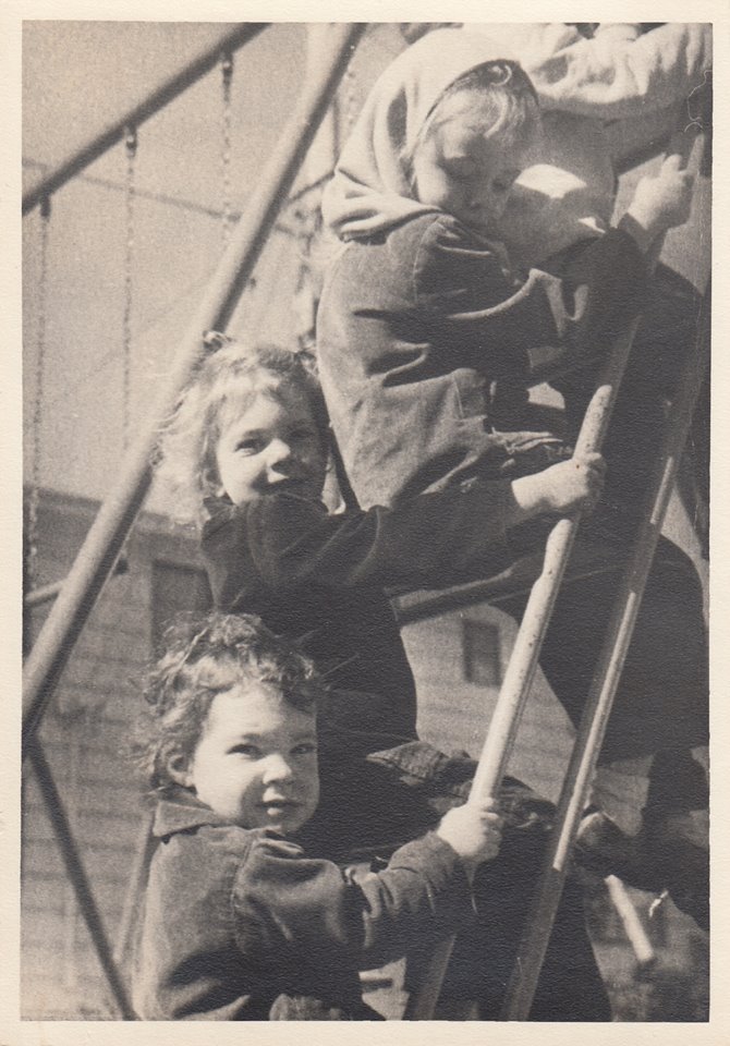 |
| Kay and Amy, Moscow playground, early 1950s |
I shed rivers of tears when Dad moved our family to another teaching post, at a state college in the deep south that was to become, in part due to my father's efforts, Clemson University. Yet my parents kept in touch, over the years, with their faculty colleagues in Moscow, and there were many visits back and forth between us and the other GI-bill educated professors from that school. I, too, kept up a childish correspondence with my best Moscow friend Suzie, sending her occasional postcards and Christmas cards until I returned to Moscow as a late-blooming teen in the summer of 1965.
Neither my parents nor I made lasting connections with our colleagues and neighbors in Clemson, South Carolina, and my experience there was less idyllic than in Idaho. Although there are a few fond memories, we were there during the final throes of racial segregation and "Jim Crow" legacy, and our family, being "Yankees," was never fully accepted within that southern town. After the riots in Little Rock, Arkansaw, that followed segregation of schools in that city, my father read the handwriting on the wall and relocated our family back to Minnesota, where he accepted an offer of a junior partnership in a small architectural practice in St. Paul. I attended a racially and culturally integrated high school in south Minneapolis, graduating with honors.
 |
| My dorm at the U of I, Shoup Hall |
 |
| lifelong friend Charlie Needles at Burning Stake, 1965 |
 |
| Richard Parker at the Burning Stake |
Highway 95 begins at the Canadian border near Bonners Ferry on the Clark Fork River and winds to the four-season tourist destination of Sandpoint, pop. 7.365, on beautiful Lake Pend'Orielle.
 |
| Family skiing at Schweitzer Mountain, above Lake Pend Orielle, 1985 |
The highway between Sandpoint and another popular tourist destination, Coeur d'Alene, is mostly four-lanes, heavily traveled and lined with RV parks, motels, gas stations, big-box stores and a large amusement park, Silverwood. The route serves the panhandle country of pristine alpine lakes, lined with vacation cabins, resorts, docks, and towering forests. The area was once notorious for a violent Aryan Nation white supremist compound at Hayden Lake, but standoffs with law enforcement resulted in a lawsuit which bankrupted the group, and it has since lost its property and dissipated.
 |
| Dave & kids skiing at Lookout Pass, east of Wallace |
Most everyone "back east" is familiar with Coeur d'Alene, as Interstate 90 threads the northern shore of that impressively beautiful mountain lake and is serviced by blocks of gas stations, motels, chain restaurants and other travelers' amenities in that bustling city of almost 45,000 population. The area is popular with vacationers and retirees from California and other west coast population centers. The lake itself is huge, fed by dozens of rivers and streams formed by the melting snows of the Bitterroot range that forms the long, irregular border between Idaho and Montana. Each stream feeds and forms its own bay in the sprawling lake, with slopes of mountains rising sharply from the banks. At one time, pines were felled and dropped into the streams to float downstream to the lake, which once served as a huge storage basin for timber. Boats and crews gathered and moved the logs to the sawmills in Coeur d'Alene, located at the mouth of the Spokane River. It was imperative to catch the logs there before they were ruined by Post Falls and, 20 miles further downstream, Spokane Falls. The falls, however, provided power for the saws and later electricity for the entire region.
 |
| Lake Coeur d'Alene |
Long-distance drivers going both directions relish the bucolic vistas after miles of the brown sagebrush of eastern Washington and central Montana.
 |
| sunset at Tubbs Hill, Lake Coeur d'Alene |
 | |
| Cub Scout Pinewood Derby, Post Falls, Idaho |
 |
| antique mining buckets |
People who wish to travel from the Canadian border or the Spokane area, or from the northern recreational areas of the panhandle to more southerly locales, including Idaho's capitol city of Boise, often avoid Highway 95 south of Coeur d'Alene, favoring the wider, better maintained highways and freeways of eastern Washington and Oregon. Even heading east into Montana on I-90 and picking up I-15 at Butte is a quicker, less treacherous route than manuevering old Highway 95 to southern Idaho. The highway is mainly a workhorse for the people who reside and work there, and for the heavy-duty industries that harvest the timber, minerals and other resources.
Heading south from Coeur d'Alene, a driver soon leaves views of the lakeshore behind, although bays of the sprawling lake continue south, hidden behind high ridges, for more than a dozen miles. The south end of Lake Coeur d'Alene is fed by the St. Joe River, considered the world's highest navigable river. It is a fun river to canoe. Barges continue to float logs down the St. Joe. Heyburn State Park is a good place to camp and canoe; there is also a National Forest campground further upriver on the St. Joe. Watch for osprey nesting on high poles and fishing in the river.
 |
| East of Hwy 95 are the rugged, mostly roadless Bitterroot Mts. |
Much effort has been put into widening 95 into four lanes going over two still-treacherous passes that connect the port of Coeur d'Alene at the outlet of the Spokane River to the high Palouse range country to the south. Leaving Kootenai County and entering Benewah County brings a driver into Indian country, specifically the Coeur d'Alene tribe. Discount smoke shops, gas stations and a sprawling casino compete for travelers' attention in the tribal villages of Worley, Plummer and Tensed (pronounced in two syllables, "ten-said.") Off the highway, streets are lined with the single-floor manufactured homes that constitute the federal government's Native American housing improvement efforts. As on most western reservations, tourist and logging facilities and boarded-up restaurants and motels are wedged into the native lands, where land was lost to outsiders generations ago in exchange for payments of some kind. But near Tensed, an impressive tribal farm and grain storage operation gleams beside the highway, where timber country meets rich, rolling Palouse farmland.
 |
| Candy-striped Palouse barn, Troy Highway, Latah County |
Generations ago, the Coeur d'Alene and Nez Perce Indians settled the river valleys and fished and hunted these lands while breeding their famous spotted ponies, the Appalloosa horses. (Early settlers who noticed one of the distinctive steeds called it "a palousey." Thus the name. A museum and interpretive center honoring this breed of horse is located at Moscow.)
 |
| Palouse Range near Deary, Idaho |
Although treacherous under icy or snowy conditions, the drive through Palouse country is quite scenic. The tops of the mountains are covered with thick pine forest; the valleys sprawl with rolling fields of small grains and legumes, primarily wheat. Since it is winter wheat, the valleys start to green up as early as February. Willows line the valley creek beds, their shoots bright orange or red, lending color to even a winter landscape. The valleys are dotted with small farms. Traffic, except for frequent logging and "chip" trucks, is light. (When I resided in Idaho as a young girl, I thought that the term "chip" referenced potato chips, since Idaho boasts "famous potatoes" on its license plates. Wrong. Potatoes only grow in southern Idaho. Chip trucks haul wood chips to plywood and chipboard processing facilities.) Semis towing large trailers with unloading chutes on the underside are ubiquitous on the northern portion of Highway 95.
The farms and ranches on the highway that parallels Highway 95 to the west in Washington, Highway 195, also known locally as "the Palouse Highway" are larger and more prosperous, with newer houses and barns. The predominantly white farmers and ranchers there obviously settled the most fertile land--although the more treeless terrain is decidedly less scenic. Although there are a few gleaming new machine sheds and midwestern-style gambel-roofed barns in Idaho, the predominant structure is the humble "Palouse barn," a two-story center building that looks like a midwestern granary, with a simple pitched roof, haymow above and room for livestock on the first level. Lean-to additions are constructed to the left and right of the main barn, providing additional livestock or storage space. Boards forming the structure are nailed vertically, not horizontally.
 |
| Barn near Potlatch, Idaho, 2011 |
The houses and outbuildings along this part of 95 have seen better days. Most are in need of paint and repairs. Discarded vehicles and machinery litter the yards.
 |
| house in Potlatch |
 |
| old truck & hoop greenhouses near Potlatch |
I have observed that old mobile homes go to rural Idaho and Montana to die. The ones in Idaho, where there is considerably more rainfall, often feature homemade auxiliary roofs mounted on posts over a rusting original trailer house roof. My architect son informs me that, in several rural Idaho counties, no building permits are required and zoning is non-existent or non-enforced. It is common to see houses constructed next door to a dilapidated, boarded-up abandoned store, a salvage yard or an active sawmill operation. All kinds of creative "make-do" structures may be observed. The residents of these scenic valleys obviously live a hard-scrabble life, probably relying on seasonal income, hunting & fishing, small pensions, day labor or subsistence farming. Roads leading east into the higher ground serve the timber towns. Much of the white pine forest is owned by timber companies, and leases are common in the national forests. The timber towns, the village of Potlatch being the one adjacent to Highway 95, are even more hardscrabble than the farming hamlets and the reservation towns along the highway. A scenic loop through the timber country of the Palouse Range, state highways 3 and 8, provides a half day of sight-seeing to anyone wishing to see the timber towns. Highway 8 terminates at Elk River, an isolated hamlet where my father once designed a gymnasium addition to the old public school. Both the school and the gym are long-abandoned. A pleasant hike leads back to Elk River Falls.
Within 15 miles of Moscow, housing begins to improve. Well-to-do professors have built new homes on the last major timber-topped ridge of the Palouse Range, Moscow Mountain, which overlooks the university town of approximately 23,000 people. Professors and business proprietors have also built new dwellings in the old timber town of Troy and the farming hamlets of Viola and Gennesee, which are within commuting distance of Moscow.
At one time, a developer purchased acreage on the south slope of Moscow Mountain and started to build a few modern homes. His efforts failed, however, as the land had served for decades as the town dump, leaving the soil is contaminated with heavy metals and radon gas. I'm not sure if the area was ever cleaned up.
 |
| Overview of Hwy 95 below Paradise Ridge, south of Moscow, 1985 |
During the 1960s, a ski resort was constructed on Moscow Mountain; it was popular with students for a few years. However, frequent chinooks melted even man-made snow and the enterprise failed. Ditto for another ski resort near Potlatch. To get consistent snow, skiers must drive further north to the higher peaks of Mt. Spokane, Schweitzer, Silver Mountain at Kellogg and Lookout Pass on the Montana border. Even those areas are subject to occasional thaws and open winters.
It is difficult to describe the Palouse if you've never seen it. It consists of a hundred-mile-long swath of rich, thick volcanic soil along the Washington-Idaho panhandle border. In Washington state, the huge hills are treeless, farmed from top to bottom. In Idaho, the fields are separated by small mountains, or foothills, capped with conifer forests. The air is crisp, fresh and often clear. The rolling hills are larger in scale and dryer than the hills in places like New England, yet there is more moisture than in the rest of the Rocky Mountains, especially in the Idaho portion. I don't know of a landscape anywhere else in the world that is like it.
 |
| Spokane River above Spokane Falls, downtown Spokane, WA |
 |
| Amy Page Wilde, Richard & Deanna Parker in front of old Nobby. |
Moscow is the dominant city of the eastern edge of the Palouse. For years, menus at the Nobby Inn on Main Street boasted that Moscow was the "lentil and dry pea capitol of the world and home of the University of Idaho." Local legend states that Campbell's Soup tried unsuccessfully to purchase the Nobby Inn's recipe for split pea soup. (The Nobby building is still open on Main Street, but it is now The Breakfast Club.)
 |
| Palouse River, Laird Park |
Every valley drains into its own creek, and the creeks drain into the Palouse River which waters this section of the high plateau that eventually drains into the Snake River, and then into the mighty Columbia River.
The origin of the town's name, Moscow, is somewhat obscure. Originally called Paradise, there are stories of early settlers and traders who were either from Russia or from Moscow, Pennsylvania, which itself was settled by immigrants from Russia.
 |
| Main Street, Moscow, Idaho |
 |
| Kenworthy Theater, downtown Moscow |
After Highway 95 leaves Moscow, it widens and crosses another 20 miles or so of Palouse cropland before plunging into the canyon floor city of Lewiston which, together with its sister city of Clarkston, Washington, lie at the conjunction of the Clearwater River tributary of the mighty Snake River which drains southern Idaho. Here barges of wheat and other commodities are loaded and shipped down the Columbia to be loaded onto ocean ships at Portland, Oregon. During the mid-1900s, Highway 95 made 33 switchbacks descending from Gennesee to Lewiston. The "Lewistton Grade" was the ultimate test for a young person's ability to handle a car or motorcycle. At the top of the grade was an overlook with a monument to the engineers who designed and built the highway.
 |
| Jane Whithead in the car we drove to Lewiston. |
I cannot forget the harrowing drive I took with my college roommate (who was aptly nicknamed "Calamity Jane") in a borrowed car in 1965, to visit her aunt south of Lewiston.
For an exciting journey down the old "Lewiston Grade," check out this youtube clip:
https://www.youtube.com/watch?v=vTSqKTaPvPc
One of the switchbacks actually swung over the border into Washington state. My parents told me that Washington state troopers used to park squad cars on that corner to ticket truckers who did not have Washington stickers on their license plates. Towards the end of the century, the highway was widened and straightened and no longer crossed the state border. There are now only 11 switchbacks between Lewiston and Gennessee. Similar re-engineering and rebuilding has also civilized the infamous Whitebird Pass grade a hundred miles to the south.
 |
| Richard & Deanna Parker's home, Clarkston, WA |
Lewsiton and Clarkston are named after the famous explorers Lewis and Clark who were the first white men to explore the region and travel the Columbia to the Pacific Ocean. After several wrong turns, they found a passage through the spine of the Rockies at Lolo Pass on the Montana-Idaho border. A paved highway was not punched through that gap until 1962, when U.S. Highway 12 finally connected Lewiston to the Montana city of Missoula. Lewiston was probably best known for its large sawmill and paper mill. For decades, timber cut in the upper reaches of the Clearwater River and its tributary, the Lochsa River, was floated west down the rivers to Lewiston for processing. This practice continued until 1967, when timber companies switched completely to trucks traveling the new highway. I observed part of the last spring log run down the Clearwater River in 1966. It was a hazardous process and much timber--and lives of lumberjacks--were lost when logs went aground or jammed while floating down the fast-moving river and men were sent out into the river with grappling hooks to try to break up the jams.
 |
| Hells Canyon, Snake River at the floor |
For many years, the paper mill polluted the air with a strong stench, but modern processing has significantly reduced the odor. After going through Lewiston, Highway 95 climbs again (although less steeply) onto a rolling plateau of farm and ranchland between the Clearwater and Salmon Rivers. The highway descends to the Salmon via the Whitebird grade to the town of Riggins. Riggins is a center for whitewater rafting.
Further upriver, the Salmon is known as the "River of No Return" because of its treacherous rapids. During their exploration of the region, Lewis and Clark were warned by the local Indians not to attempt to cross or raft the Salmon river, but to head back north and find Lolo Pass into the Lochsa/Clearwater watershed instead, even though that required many more days of travel.
 |
| Seven Devils Mountains, Hells Canyon |
Central Idaho is also "Chief Joseph" country. This famous leader of the Nez Perce Indians valiantly defended his people's way of life and led them on a perilous flight through Central Idaho before finally surrendering to the U.S. Army in order to preserve the lives of the women and children of his tribe who were beginning to perish from the stress of the journey. There are several Nez Perce reservations here and in northeastern Oregon, west of Hells Canyon. Throughout this region, numerous historical markers commemorate the efforts of the Nez Perce tribe, Chief Joseph and the earlier Lewis and Clark expedition.
 |
| Sawtooth Mts & upper Salmon River, Stanley, Idaho |
Highway 95 threads more mountain valleys between the Salmon River and Idaho's potato farming region, which is located upriver from Hells Canyon on the Snake River. Central Idaho is home to some of the most rugged and unforgiving mountain terrain on the continent. The highway between Grangeville and Council is two-lanes and treacherous during rainy, foggy or snowy weather and narrow. At the top of Whitebird Pass, there is another monument to the engineers who designed and built the road. A large ski resort is located east of the highway in south central Idaho at McCall.
Northwest of Boise, the highway widens and becomes more like typical U.S. highways in other states. It continues south and west to serve a more populated farming and ranching area in southwestern Idaho. Irrigated potato fields, farm implement dealerships and herds of beef cattle and sheep may be seen along the southern stretches of Highway 95 near Caldwell, Nampa and Payette. Eventually it crosses the border into southeastern Oregon, and cuts through a corner of that state before entering northern Nevada.
(Thanks to my former U of I classmates Richard and Deanna Parker for the link to the video clip of the old Highway 95 Lewiston grade and the photo of their home.)
No comments:
Post a Comment